Wednesday 28.08.2019 (15:00-18:00) and Saturday 31.08.2019 (14:00-18:00)
Where: Spacecraft_ZKM, Friedrichsplatz, Karlsruhe
- 14:00/15:00-18:00 open Workshops
- 15:00 and 17:00 Talk: Satellite images – more than maps and navigation!
Karlsruhe applied for UNESCO City of media arts, and the museum ZKM organises the Seasons of Media Arts about public participation together with local groups, e.g. the Open Knowledge Lab Karlsruhe.
Satellite images – more than maps and navigation!
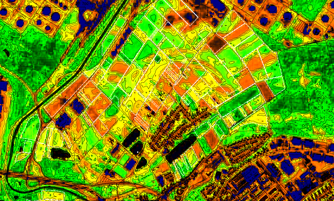
The European satellite missions of the ESA generate a steady stream of new data from space. The Copernicus Missions provide the satellite data as open data. We want to inform about the images and their potential.
These data sets are to be used by governments, citizens and any stakeholders and we want to answer some questions and discuss publicly:
- What is open data?
- How do earth observation and remote sensing work?
- What satellite data is freely available?
- What can I use it for?
- Use cases in agriculture, settlement development
- Project Open Forecast: open data services
- How can I access data sets?
- Data portals of the EU and national states
- What apps are there?