
The results of the AgriCOpen use case are available at our geodata service geoserver.gwdg.de and is described here on the GDI-BW Metadataportal
Author: sbinger1
An interactive model for the analysis of air quality simulations
As part of the Particulate Matter Forecast Service, a model was developed to facilitate the access to results of the WRF simulations. A 3D visualisation for air quality in the greater area of Stuttgart was created using the software Vistle. This allows an interactive exploration of the model along with other data sets. Users can navigate through the virtual world and switch between various modes to examine multiple data sets simultaneously. This enables a combination of simulation data with geo data and thus establishes points of reference for users. Moreover, it allows the comparison of multiple components such as the concentration of nitrogen oxide and particulate matter.
The following video gives insights into this model and demonstrates its application in virtual reality environments.
FOSSGIS 2020 talk
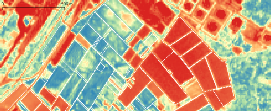
The FOSSGIS 2020 Conference is currently held at Freiburg and the talk Offene Smart Farming Produkte aus offenen Satellitendaten (Open smart farming products based on open satellite data) was recorded and the video is already online. The presentation is also availailable online.
Open Forecast presentation at FOSSGIS conference 2020
We are happy to announce that our presentation at the FOSSGIS conference is accepted: https://www.fossgis-konferenz.de/2020/sessions/PHJ8VG.php We will present the latest results of our project with focus on the AgriCOpen use case.
Satellite data for agriculture

In the journal Landinfo, issue 5/2019, an article was published (in German) about satellite data. Other articles focus the topic digitization in agriculture.
Landinfo Issue 5/2019, article: Satellitendaten für die Landwirtschaft – Digitalisierung als Trend (PDF)
QGIS DE User meeting
The QGIS user group Germany conducts user meetings (Anwendertreffen) also this year, there are even two meetings in parallel (in Detmold and Gelsenkirchen).
QGIS is a free GIS, supporting all kinds of geo data processing, which provides extensive possibilities to be adapted and extended.
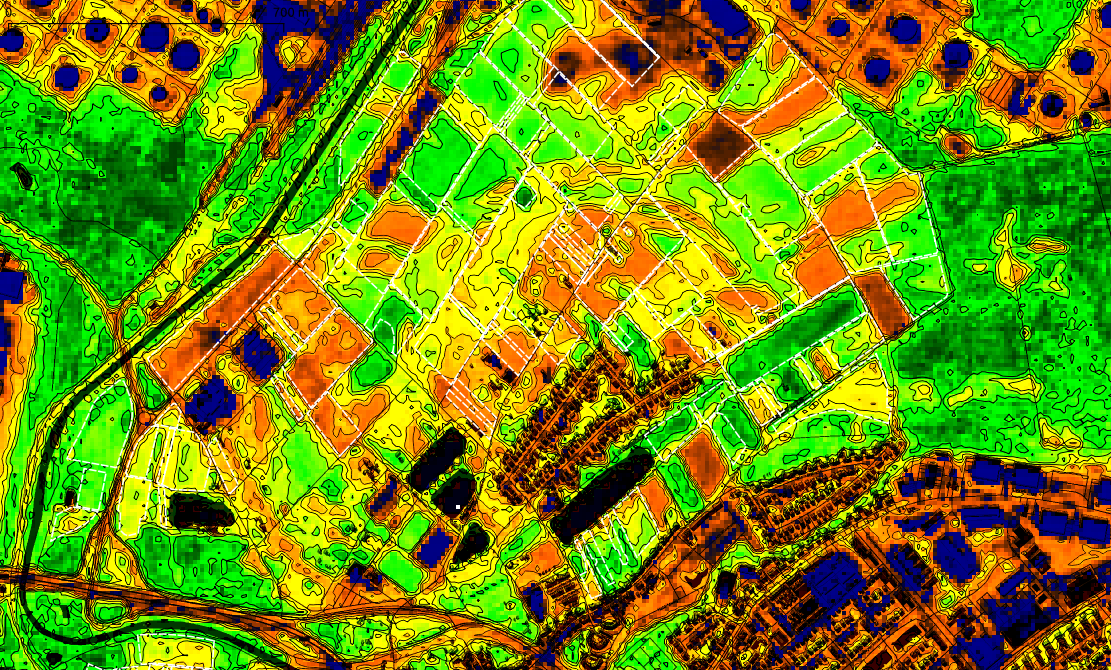
QGIS supports the analysis and usage of raster data, e.g. satellite data, and vector data, in agriculture these are field geometries or application maps.
Open data from space for anyone
The Copernicus Missions provide the satellite data as open data. We want to inform about the images and their potential.
Wednesday 28.08.2019 (15:00-18:00) and Saturday 31.08.2019 (14:00-18:00)
Where: Spacecraft_ZKM, Friedrichsplatz, Karlsruhe
- 14:00/15:00-18:00 open Workshops
- 15:00 and 17:00 Talk: Satellite images – more than maps and navigation!
Karlsruhe applied for UNESCO City of media arts, and the museum ZKM organises the Seasons of Media Arts about public participation together with local groups, e.g. the Open Knowledge Lab Karlsruhe.
Satellite images – more than maps and navigation!
The European satellite missions of the ESA generate a steady stream of new data from space. The Copernicus Missions provide the satellite data as open data. We want to inform about the images and their potential.
These data sets are to be used by governments, citizens and any stakeholders and we want to answer some questions and discuss publicly:
- What is open data?
- How do earth observation and remote sensing work?
- What satellite data is freely available?
- What can I use it for?
- Use cases in agriculture, settlement development
- Project Open Forecast: open data services
- How can I access data sets?
- Data portals of the EU and national states
- What apps are there?
GS 2019
Open Forecast goes to Geospatial Sensing
52N hosts the conference Geospatial Sensing – from sensing to understanding our world and Open Forecast will take part.
The conference takes place September 2 – 4, 2019 in Münster (Germany).
See the homepage for all of the details.
Earth observation networks, e.g. in-situ sensors and remote sensing systems, deliver a multitude of data capturing the state of our environment. The data sets delivered are highly valued by scientists and other stakeholders from various domains and backgrounds such as hydrology, marine sciences, traffic management, environmental monitoring, energy supply or smart city systems. An active research and development community works on new approaches to share, manage, discover, analyze, and visualize such sensor data. The Geospatial Sensing Conference gives an overview of current developments and provides a discussion platform for scientists, developers and users.
GS 2019
Program overview
Day 1: Tutorial Sessions
Day 2: Conference
Day 3: Interactive Workshop
Thanks for the organisation go to 52° North Initiative for Geospatial Open Source Software GmbH, see you there!
CGIAR big data in agriculture convention
TRUST: Humans, Machines & Ecosystems is the topic of the meeting organized with the CGIAR platform for big data in agriculture and held at ICRISAT campus in Hyderabad, India during 16-18 October. https://bigdata.cgiar.org/hyderabad-2019/
The Platform for Big Data in Agriculture harnesses the power of big data for agricultural research and development.
40. GIL annual conference 2020
Digitalisierung für Mensch, Umwelt und Tier (digitalisation for humans, environment and animals) is the topic of the 40. GIL annual conference in the year 2020.
- Date: 17.02. – 18.02.2020, Weihenstephan
- Call for Papers
- Conferences of the GIL